

KakaoMap vs Naver Map in Korea is a practical question for visitors because Seoul Metropolitan Government names both apps as database-sharing map apps for bus tracking and route information. This guide explains when to use each app, how to search Korean addresses, and how to avoid common navigation mistakes when Google-style place searches do not give enough local detail.
Korea’s navigation environment is closely connected to local-language place names, public-transport data, subway exits, bus-stop IDs, and building-level addresses. For most visitors, the safest approach is not to choose one app forever, but to install both KakaoMap (카카오맵) and Naver Map (네이버 지도) before arrival.
1. Why KakaoMap vs Naver Map in Korea Matters
Map apps in Korea are not only for walking directions. Travelers use them to check subway exits, bus arrival information, taxi destinations, restaurant locations, hotel entrances, and the Korean spelling of a place.
The Seoul Metropolitan Government states that buses can be tracked through bus-stop information terminals, the Seoul TOPIS website and mobile app, and database-sharing map apps including Naver Map and Kakao Map. The same official page says Kakao Map and Naver Map offer shortest-route information, public-transportation recommendations, and live bus tracking.
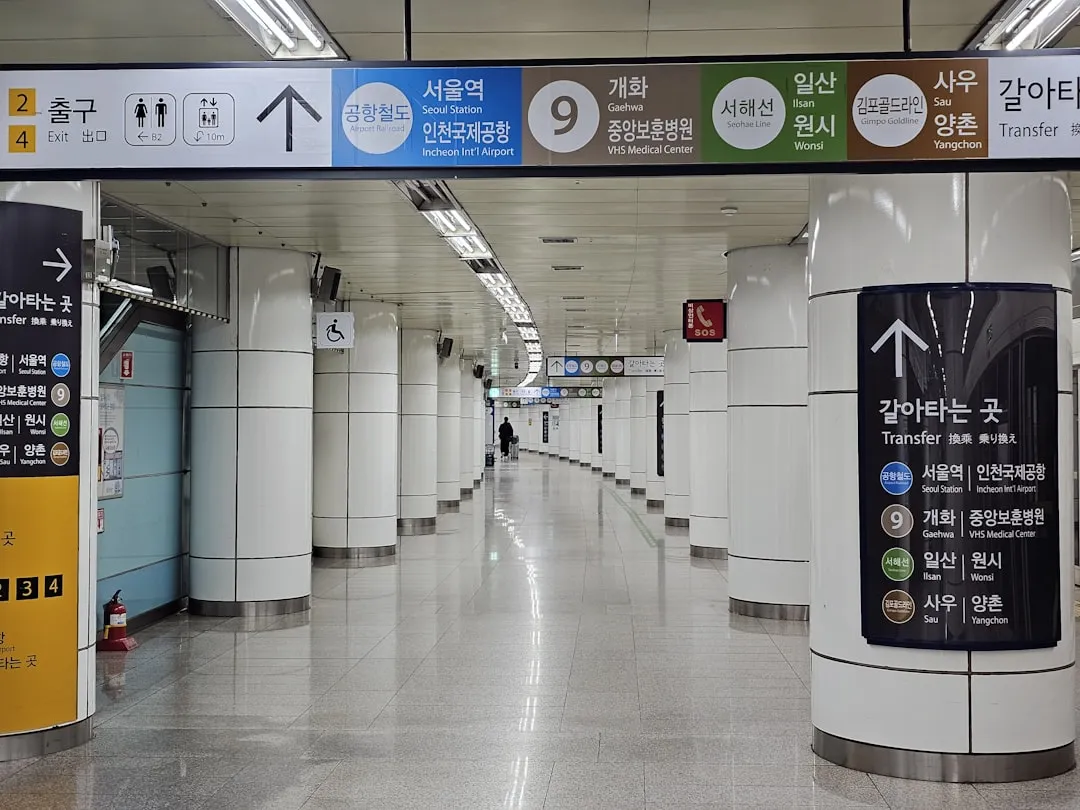
Visit Seoul also notes that smartphone and tablet users can download apps that provide routes, times, and transfer information in English, including Subway Navigation by Kakao. In practical terms, this means a local map app can be more useful than a generic international map when the task depends on live bus data, station exits, or Korean place names.
Visitors should still treat every app result as travel guidance, not a legal or official notice. Station signs, operator announcements, hotel instructions, attraction notices, and public-agency websites should take priority when there is a conflict.
💡 Local Hack: Save destination names in both English and Korean. A hotel or restaurant name in Hangul often works better for taxi drivers, station staff, clinic reception desks, and delivery-style address searches.
2. The Short Answer: Which App Should You Use?
Use KakaoMap when you want a transport-heavy navigation app with strong route planning, station exits, bus movement, and Korean address handling. It is also useful when a traveler is already using other Kakao services in Korea.
Use Naver Map when you want broad place search, restaurant and shop listings, business information, saved places, and Korean-language place matching. Many visitors use Naver Map as the main place-search app and KakaoMap as a cross-check for routes.

The best answer for most foreign travelers is to use both. Search the same hotel, restaurant, clinic, station, or attraction in both apps before important moves, especially on arrival day, before late-night transfers, or when traveling with luggage.
- For subway and bus routes: compare route time, transfer count, and exit number in both apps.
- For restaurants and cafes: check the Korean name, building floor, and nearby landmark.
- For taxis: copy the Korean destination name or road-name address.
- For accommodation: confirm whether the app points to the main entrance, back entrance, or nearby building.
This comparison is especially useful in Seoul, where large stations may have many exits and underground connections. It is also useful in Busan, Jeju, Incheon, and other destinations where romanized English spellings can vary.
3. Step-by-Step Guide for Using Korean Map Apps
Step 1: Install both apps before departure. Download KakaoMap and Naver Map while you still have stable internet access, then check whether the app language settings and account options work on your phone.
Step 2: Save your hotel in Korean. Copy the Korean hotel name and address from the hotel confirmation or official hotel website. If the hotel has several branches, include the district name, such as Myeongdong (명동), Hongdae (홍대), Gangnam (강남), or Jongno (종로).
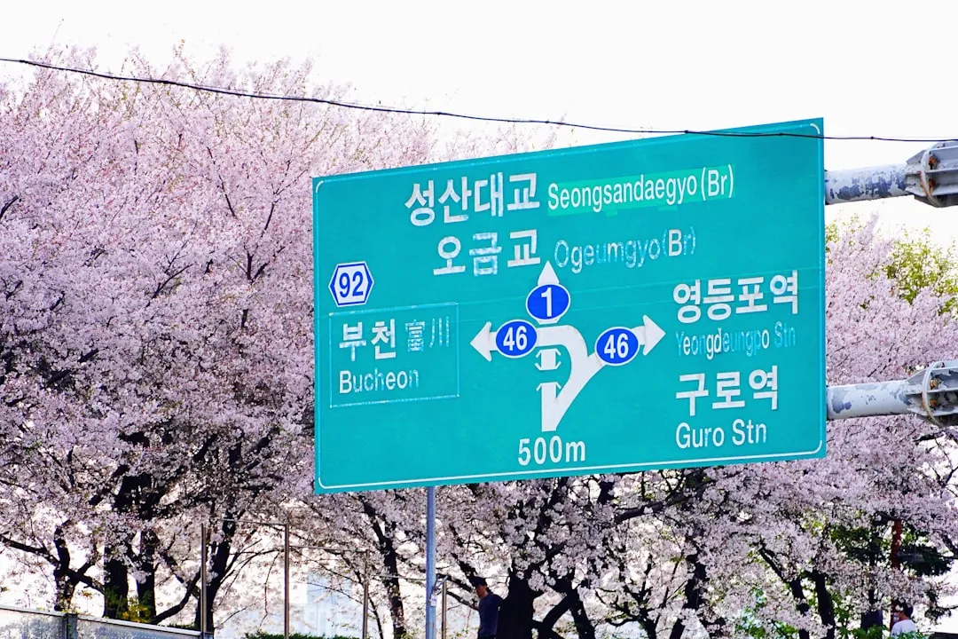
Step 3: Search the Korean name first. English names can be useful, but Korean map databases often match more precisely with Hangul. If an English search gives several similar results, paste the Korean address or phone number instead.
Step 4: Check the subway exit. In Korea, a station name alone is often not enough. A large subway station may have several exits spread across different blocks. Check the exit number, then compare the walking route from that exit to the destination.
Step 5: Check live bus information carefully. Seoul Metropolitan Government explains that Seoul’s bus information system provides estimated arrival time, time left for arrival, current bus location, and intervals between buses. Use this information to reduce waiting time, but confirm the bus direction and stop number before boarding.

Step 6: Send the Korean destination to a taxi driver. When taking a taxi, show the Korean address or the map pin. Do not rely only on a romanized neighborhood name, because several places can sound similar in English.
Step 7: Cross-check before late-night travel. Subway, bus, taxi, and walking options change by time of day. Before evening plans, check the route again and confirm whether a late-night bus, taxi, or shorter walking route is needed.
4. Pro Tips and Warnings for Foreign Visitors
Do not assume that the first search result is the correct place. Korea has many chain cafes, clinics, pharmacies, convenience stores, and restaurants with similar names. Confirm the district, branch name, phone number, building name, or nearby station.
For tourist routes, combine a map app with official tourism information. Visit Seoul provides transportation guidance for Seoul, including subway information, Tmoney references, and route-related tools. The Seoul Metropolitan Government public-transportation page gives official explanations of bus use, transport cards, and bus tracking.

🚨 Important Warning: A map app may show a route that is technically possible but uncomfortable with large luggage, rain, stairs, or late-night arrival. For airport arrival or hotel transfer, compare walking distance, transfer count, elevators, and final-street access before choosing the shortest route.
- Use road-name addresses: Korean addresses may appear as road-name addresses or older land-lot style addresses. Save the format shown by the hotel or official venue.
- Check floors: Restaurants, clinics, salons, and small offices may be above street level or inside mixed-use buildings.
- Watch station exits: A route can change meaning completely if you leave through the wrong exit.
- Use phone numbers: A business phone number can help confirm the correct listing when names are similar.
- Keep screenshots offline: Save your hotel address, route, and emergency contacts before leaving Wi-Fi.
For planning a Seoul itinerary around map-app routes, TripKorea’s internal pages can help match routes with districts: Seoul hotels by area, things to do in Seoul, and Seoul transport options.
5. Practical Use Cases: KakaoMap vs Naver Map in Korea
Airport to hotel: Search the hotel name in both apps, then check whether the destination pin is the main entrance. If arriving through Incheon International Airport or Gimpo Airport, compare rail, airport bus, taxi, and walking portions separately.
Subway transfer: Check the transfer station, exit number, and walking route after exit. If the route includes a large station such as Seoul Station, Hongik University, Gangnam, Jongno 3-ga, or Express Bus Terminal, leave extra time for walking inside the station.
Bus route: Use live bus tracking where available. Seoul Metropolitan Government’s public-transportation guide states that bus information includes estimated arrival time, current bus location, and intervals between buses. Match the bus number and direction before boarding.

Taxi destination: Show the Korean address or map pin to the driver. For hotels and attractions with similar names, include the district and nearby subway station. If communication is difficult, call 1330 for tourist interpretation support or use BBB Korea 1588-5644 for interpretation.
Restaurant search: Search by Korean name, then check branch details. Restaurant listings can have similar names, and some businesses are located above or below ground level. If a restaurant uses a waiting system or call button, the app may help you identify the building but not the full ordering procedure.
Emergency or clinic route: Use a map app only to navigate. For emergencies, call 119 for fire or emergency medical assistance, 112 for police, 1330 for tourist interpretation, or 1345 for immigration and foreigner guidance. Do not delay an emergency call while comparing app routes.
Frequently Asked Questions
Q: Is KakaoMap better than Naver Map in Korea?
A: There is no single official ranking. KakaoMap is often useful for transport-heavy route checks, while Naver Map is often useful for broad place search and Korean listing details. Most visitors should install both and compare important routes.
Q: Can tourists use KakaoMap and Naver Map in English?
A: Both apps provide foreign-language support to varying degrees, but search precision may improve when you use the Korean name or address. Save key destinations in Hangul before travel, especially hotel names, clinics, stations, and restaurants.
Q: Why is the Korean address important?
A: Korean place names can have several romanized spellings, and chain businesses may have many branches. A Korean road-name address, phone number, or map pin helps reduce the risk of going to the wrong branch.
Q: Which app should I use for Seoul buses?
A: Seoul Metropolitan Government names Naver Map and Kakao Map as map apps connected to bus tracking information and says they offer route information, public-transportation recommendations, and live bus tracking. Check the bus number, direction, and stop before boarding.
Q: Should I still use official transport websites?
A: Yes. Map apps are useful for route planning, but official transport websites, station notices, operator announcements, and airport or city authority pages should be checked when schedules, fares, closures, or rules matter.
For most travelers, the practical answer to KakaoMap vs Naver Map in Korea is simple: use both, search in Korean when possible, check subway exits and bus stops carefully, and keep official transport sources available for final confirmation.
Sources & References
Official Tourism and Government Sources:
- Seoul Metropolitan Government: Public Transportation
- Visit Seoul: Transportation
- Seoul Public Transportation / TOPIS
- Visit Korea
Map Services:
Helplines: Tourist 1330 / Foreigner 1345 / Emergency 119 / Police 112 / BBB Korea 1588-5644
Image Credits: Hero and street navigation: noo jang / Unsplash. Subway platform: KS KYUNG / Unsplash. Subway sign: Ryoo Geon Uk / Unsplash. Street sign: IRa Kang / Unsplash. Bus-stop waiting: Jo Quinn / Unsplash. Station area: Alisa Danyuk / Unsplash. Street traffic: Will Ma / Unsplash.
Last verified: August 21, 2026
Transport apps, route data, service names, fares, and operating information can change. Always confirm important travel details through official transport operators, station notices, and public-agency sources before travel.